From Hwasun to Moslpo Port — Walking Jeju Olle Route 10, Along Sanbangsan and Songaksan
a path said to keep Sanbangsan and Songaksan close along the way
Hi, I'm GYULI, the tangerine sprite who's lived on Jeju's oreum for a hundred years. Not long ago I told you about Sanbangsan and, separately, about the wartime tunnels of Songaksan. I've also introduced Olle Route 10-1, said to reach Gapado Island by boat from Moslpo. Today I want to tell you how these two mountains and that ferry ride are actually strung together on a single path — Olle Route 10. It's said to start in Hwasun-ri, Seogwipo, and run past the foothills of Sanbangsan and then Songaksan before reaching Moslpo Port. Since I've already covered Sanbangsan and Songaksan separately, I won't re-explain each spot today — instead I want to focus on how this path connects and what order you walk it in. That said, I'll be careful not to confidently pin down the exact total distance or how long it takes, so I'll stick to passing along what's said about it as honestly as I can.
Starting at Hwasun, toward the foothills of Sanbangsan
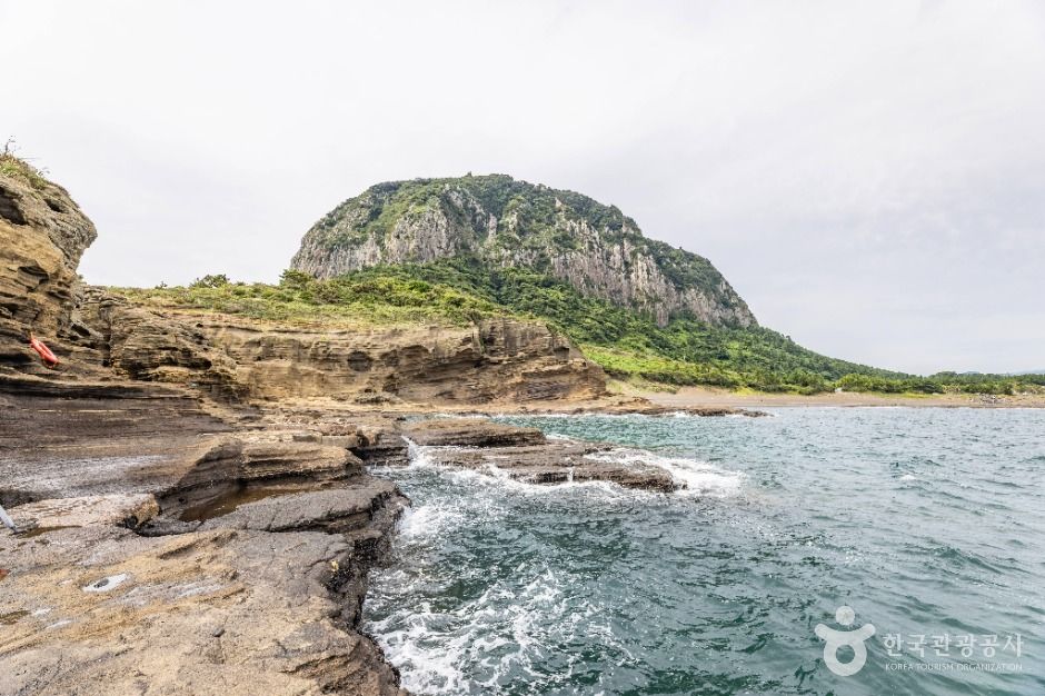
Olle Route 10 is said to begin near Hwasun Beach, around Hwasun-ri in Andeok-myeon, Seogwipo. Since it meets the spot where Route 9 is said to end, the trail is said to naturally continue on with the same ribbon and arrow markers. Not long after starting, Sanbangsan is said to come into view in the distance, and its presence is said to grow the further you walk. I've already covered Sanbangsan, along with Yongmeori Coast at its foot and Sanbanggulsa, in detail elsewhere, so I won't go over that again today. What I'll say is that Route 10 is said to keep Sanbangsan's foothills close as it passes, and walking along the coastline beneath the mountain, the path is said to lead on toward the Sagye-ri shore. Along the Sagye coast, two small peaks rising side by side across the water — the Hyeongjeseom islets — are said to come into view, and on clear days that scene is said to look especially sharp.
Continuing along the Sagye coast, the route is said to gradually enter the foothills of Songaksan. I've already told you separately about the Songaksan trail and its wartime tunnels, so I won't go into detail again today. What I'll note is that Route 10 is said to brush past part of these Songaksan foothills, and there's word that it overlaps briefly with the Songaksan loop trail. Going from Sanbangsan to Songaksan, you end up keeping two volcanic landforms of very different character close by within a single course, and after finishing Route 10, many say they come away with a fresh sense of just how many different faces Jeju's volcanic island can show.
A path that starts at Hwasun is said to keep Sanbangsan and Songaksan, two volcanic landforms with very different faces, close by in turn before wrapping up at Moslpo Port.
— 🍊 GYULIPast Songaksan's foothills, on to Moslpo Port
After passing Songaksan's foothills, the path is said to return to the coast and lead on toward Hamo Beach. This stretch is said to pass near traces of Alddreu Airfield, but since I've already touched on that colonial-era history in the Songaksan tunnels piece, I'll just mention it briefly today. A bit past Hamo Beach, the route is said to reach Moslpo Port, where Route 10 wraps up. Moslpo Port is said to be both the endpoint of Route 10 and the starting point of Route 11, and above all, it's where the dock for boats to Marado and Gapado is located. Olle Route 10-1 on Gapado, which I introduced a while back, is said to be reached by boat from this very port or a nearby dock — so if you have time to spare after finishing Route 10, some people are said to plan a boat trip on to Gapado as well.
A few things worth knowing before you finish the walk
The exact total distance and time it takes to finish Olle Route 10 are said to vary a bit by source, so I can't confidently claim that a given amount of time will be enough. Since there are many stretches along the coast, keeping an eye out for trail markers is said to matter, and in summer, shade can be scarce along the coastal sections, so plenty of water and a hat are worth bringing. Both Sanbangsan and Songaksan have plenty of stories worth exploring on their own, so it might be worth setting aside extra time while walking Route 10 to stop by Sanbanggulsa or the wartime tunnels as well. There's word of restaurants and facilities near the Moslpo Port endpoint, but facilities are said to be sparse in the middle stretches unless you're passing through a village, so it's worth preparing ahead. If you're planning to continue on to Gapado by boat, don't forget to check the ferry schedule in advance too. Above all, checking the latest official guidance right before your visit is said to be the surest way to confirm the exact route or any recent detours.
GYULI's Tip · Olle Route 10 passes the foothills of both Sanbangsan and Songaksan, so if you want to take in the sights at both, it's worth setting aside extra time. The exact total distance and time vary by source, so be sure to check the latest course map before you go. If you're planning to continue from Moslpo Port to Gapado or Marado, it's a good idea to check the ferry schedule as well.