From Moseulpo to Muryeong, Through Gotjawal Forest and Midland Trails
a route said to link gotjawal forest and midland trails
Just as Jeju Olle Route 10 is said to wrap up at Moseulpo, the route GYULI is introducing today, Route 11, is said to pick up right where that leaves off, starting from the very same Moseulpo Port. Said to run from Moseulpo Port in Daejeong-eup, Seogwipo, to Muryeong-ri in Hangyeong-myeon, this route takes a different direction from Route 10-1, the loop around Gapado Island introduced earlier — while that route circled an island out at sea, Route 11 is said to turn inland instead. It's known for passing through gotjawal, a forest unique to Jeju, and trails through what's called jungsangan, the midland villages, so it's said to offer a different mood from the earlier routes that hugged the coastline. Moseulpo is also well known as the port where ferries to Marado and Gapado depart, so many of you have likely passed through it before, but this time it's a route you take on foot, heading inland instead of boarding a boat. Today GYULI will walk through what kind of route Route 11 is said to be, and what its gotjawal forest and midland trails feel like. I'll be careful not to confidently pin down the exact distance, how long it takes, or the fine details of each point along the way, so I'll stick to passing along what's said about it as honestly as I can.
From Moseulpo Port to Muryeong-ri, a change in direction
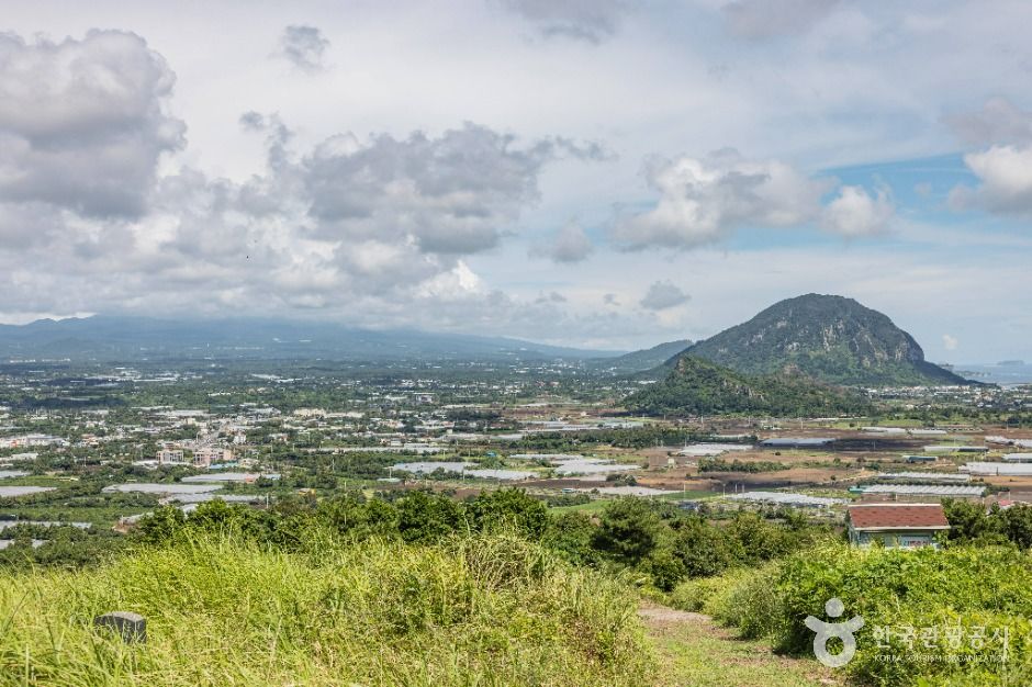
Route 11 is said to start at Moseulpo Port. Moseulpo in Daejeong-eup may be familiar to many as the port where boats to Marado and Gapado depart, and Route 11 is said to turn its back on that port and head toward Muryeong-ri in Hangyeong-myeon. While earlier routes tended to mostly follow the coastline, Route 11 is said to stand out for veering inland partway through, into what's known as the jungsangan, or midland, region. Jungsangan is a term said to refer to the stretch of land between Jeju's coastal villages and Hallasan, where low oreum, fields, and forest are mixed together, and it's said to be frequently mentioned by those who walk this route that the scenery suddenly shifts from ocean views to green forest and farmland. Muryeong-ri is a village in Hangyeong-myeon said to show a quiet, modest midland village landscape. There's also word that villages, fields, and forest alternate along the way from Moseulpo to Muryeong-ri, which seems to be part of the route's appeal — encountering several different landscapes within a single course.
Gotjawal and midland trails, this route's own charm
The name that comes up most often about Route 11 is said to be gotjawal. Gotjawal is said to refer to a forest unique to Jeju, where trees, vines, and moss grow tangled together over rugged lava terrain formed by volcanic activity, and it's said to be home to a distinctive ecosystem rarely seen elsewhere. Trees rooted between cracks in the rock, and a rugged, uneven stone path underfoot, are said to be frequently cited features of the gotjawal stretch. There's also word that the forest shade makes for noticeably cooler walking even in summer, which some say gives it a different charm from coastal routes walked under the blazing sun. After the gotjawal stretch, the route is said to lead back into midland villages and farm paths, and with little elevation change, it's often introduced as a course that can be walked without too much strain. That said, the forested stretch is also said to have plenty of dirt and stone paths beneath its shade, which can get slippery after rain, so it's worth packing sturdier footwear.
Turn your back on Moseulpo Port toward the forest, and another side of Jeju held within the gotjawal is said to be waiting.
— 🍊 GYULIGood to know before walking the route
Before walking Route 11, there's said to be some different preparation needed compared to coastal routes. While the earlier seaside routes were said to be defined by wide-open views and strong sun, Route 11 is said to alternate between forest and village paths, so while shade is plentiful, the terrain itself is said to vary quite a bit. In the gotjawal stretch, there's word that tree roots and rocky outcrops are common, so it's worth watching your footing carefully, and the ground can get slippery right after rain, which is worth keeping in mind. The midland village stretch including Muryeong-ri is said to be relatively quiet, so it may take a while to come across a convenience store or restaurant, making it safer to bring water and a light snack in advance. The Moseulpo Port area is also said to have facilities related to ferry travel clustered together, making it a convenient spot to prepare before setting off. How long the full route takes is said to vary depending on your pace and how much time you spend lingering in the gotjawal stretch, so I can't confidently claim a set amount of time will be enough. That said, with little elevation change and a mostly gentle path, it's often introduced as a route you can take on without too much worry.
GYULI's Tip · The gotjawal stretch has plenty of tree roots and stone paths, so wear comfortable walking shoes, and be extra careful right after rain since it can get slippery. The Muryeong-ri side runs through midland villages where amenities may be scarce, so it's a good idea to pick up water and snacks near Moseulpo Port beforehand.